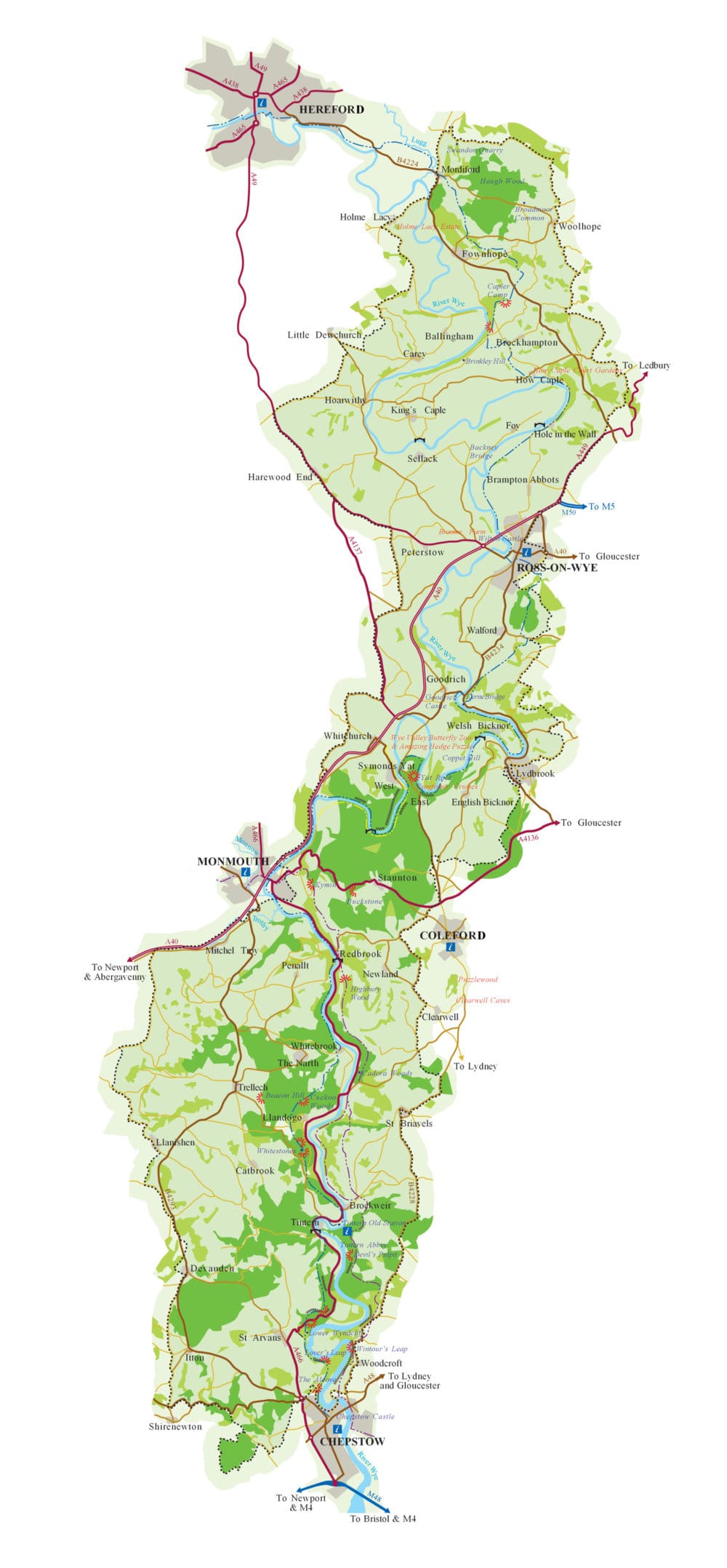
The boundary of the Wye Valley National Landscape is the black dotted line on the map below, covering 128 square miles from Mordiford, south east of Hereford, down 58 miles of the lower Wye to Chepstow.
More detailed maps of the Wye Valley National Landscape boundary are available through the links below.
Google Maps Quick & easy to see the Wye Valley National Landscape boundary and what’s in & out. However it doesn’t have detailed/OS map base nor show the National Landscape on Satellite view
National Landscapes Association – interactive map Scroll down and click on ‘Map View’. Zoom in on the Wye Valley and see the National Landscape boundary and what’s in & out. However, background base map is shaded Google Map, not detailed OS map, and the National Landscape ‘darkens’ once selected, obscuring the base map further
Data Map Wales Welsh Government Interactive Map Browser: This has the detailed National Landscape boundary (with a transparent colour fill) on OS base map – covering England & Wales. You can ‘add data’ layers and access huge amount of additional data primarily for Wales – very useful.
MAGIC – DEFRA interactive map Click on ‘Get Started’ to open the ‘Multi-Agency Geographic Information for the Countryside’ map. Then open the ‘Map Layers’ button (top left) and click on ‘Designations’ + ‘Land-Based Designations’ + ‘Statutory’+ ‘Areas of Outstanding Natural Beauty (England)’. This also has the detailed National Landscape boundary (with a polkadot colour fill) on OS base map – covering England & Wales. You can lots of MAGIC ‘Map Layers’ and access huge amount of additional data primarily for England – very useful.